Neah Bay to Sol Duc
The middle part of my 12 days in Olympic National Park (and surroundings) turned out to be a wonderful time where I began to feel a real connection with the park. I had never stayed for so long in this beautiful place - in fact, I don’t think I’d ever spent that much time in any national park area. Monday morning, after arousing and making breakfast in Merlin in the wide-open space of Hobuck Beach Campground, I drove out to Cape Flattery. On the short drive to the Most Northwest Point in the continental U.S., I drove through thick stands of fog and also pockets of sunshine. So, at least it wasn’t at all cloudy - just very foggy. Hopefully, I’d have good views of Cape Flattery and Tattosh Island - as my goal was to see Tufted Puffins!
Before entering the Cape Flattery area, I drove through a Makah tribal checkpoint to ensure I had purchased a pass. The attendant saw my neon pink card in the windshield and waved me through. I parked Merlin at the nearly empty Cape Flattery trailhead - which is maintained by the Makah Tribe. I recalled a previous visit to this area about 25 years ago when my folks visited from Illinois and we did an Olympic Peninsula loop. What memories! I started hiking and immediately heard the haunting whistle of two Varied Thrushes communicating with each other. Shortly, I reached the platform at the end of the trail which overlooks the mighty Pacific Ocean and Strait of Juan de Fuca. What an amazing corner of the country. And, Tattosh Island was enshrouded in fog! I scanned and listened to the various seabirds in the area - lots of Pigeon Guillemots going to and fro their cliff-side nesting colonies. Pelagic cormorants flying low over the water. A handful of Olympic gulls. Various people came to the platform and inquired about my scope and what I was observing - most of them thinking I was looking at whales. It’s always interesting when I’m scanning with a scope over the Sound or on the Coast and people ask me about whales…when I respond that I’m looking at birds, most of them lose interest! But, then when I said I’m looking for Tufted Puffins - most people perked up!
Every so often, someone would say they saw a Tufted Puffin and I’d go look - and it would be a Pigeon Guillemot (the red mouths seems to confuse some folks). I talked with people from all over the U.S. on that platform - it was really fun to talk with people about birds, the landscape of the region, the weather. Finally, after about 2 ½ hours, the fog started to dramatically lift off Tatoosh Island and the entire island - including the old lighthouse - was visible. I scanned with my scope… there were SO MANY BIRDS all over and around that island. And, within a few mins, I spotted 6 Tufted Puffins which I yelled out. I shared the scope with any curious onlookers - several people wanted to see the puffins. They were quite a ways out - so the spotting scope was critical to really see them. What a really fun experience! After talking Tufted Puffins with folks, I finally left around noon and headed to the Makah tribal museum in the town of Neah Bay. This is a world-class museum with artifacts unearthed from a Makah village that was submerged under a mudslide in the 1600s. The items are exceptionally preserved - which is unusual for most Indian archeology in the PNW due to our incessant damp/wet climate, especially along the Coast.
After the museum, I made the decision to drove to Ozette Lake and try my luck at getting a spot there. It’s a pretty lake with a small National Park campground and a major trailhead to the Ozette triangle loop which navigates through coastal Sitka Spruce forest to the beach and back in a triangle loop. I drove the 2-2.5 hours from Neah Bay to Ozette and found a few open campsites (it was a Monday late afternoon). I found one in the open sun right near the water. And, I decided to take out my Kokopelli inflatable packraft. It was my first time using the little kayak and it worked out well in this lake. I paddled around for about an hour or so and enjoyed the views of the Olympics (including Mt. Olympus!) and the surrounding forest. It’s a very peaceful and tranquil lake in the national park. That night, I hung out along the lake with a couple other people who were on big road trips in the PNW.
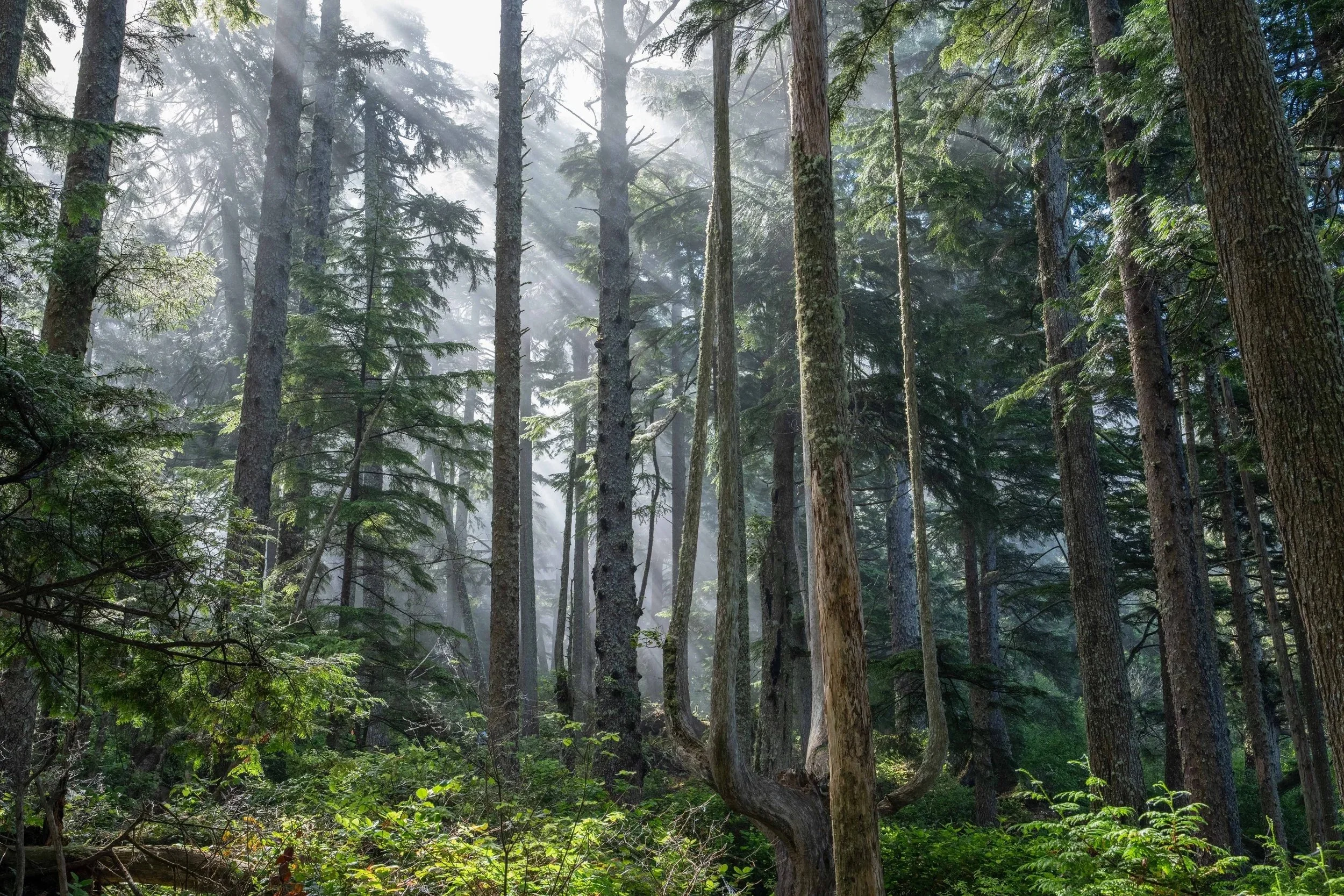
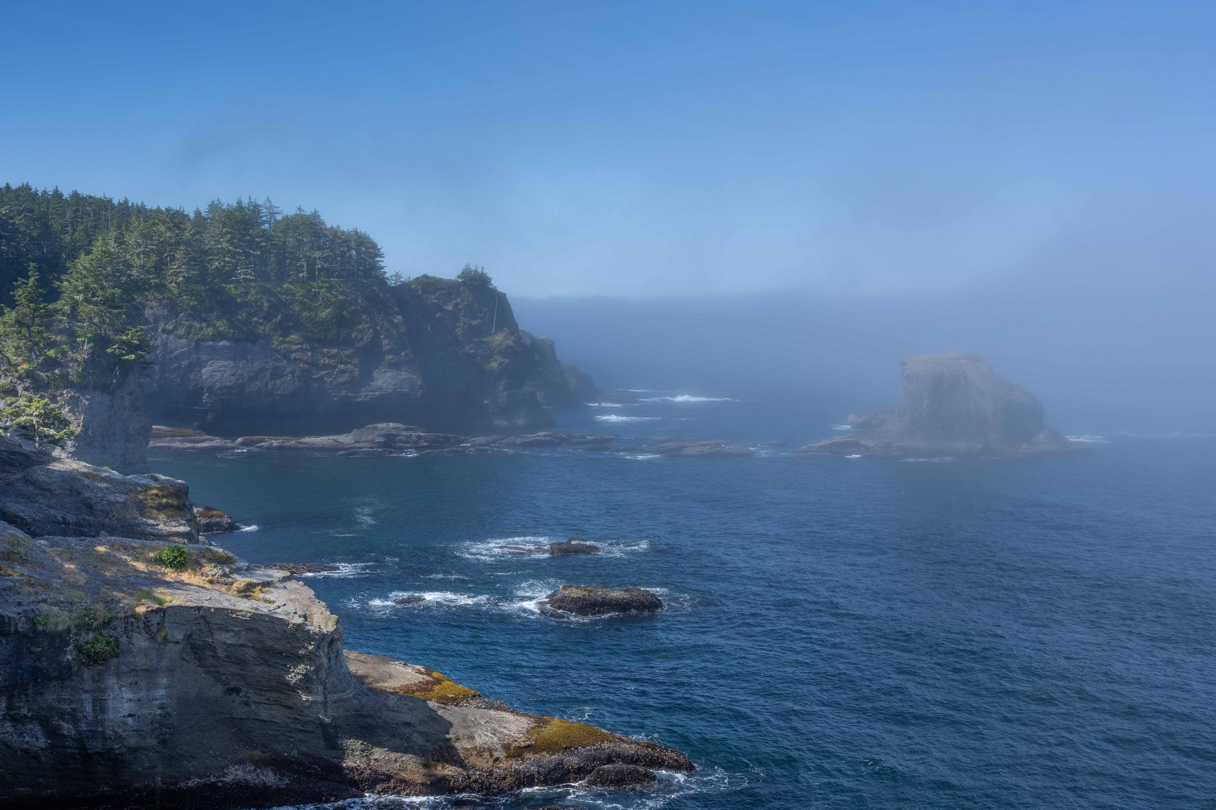
The next day, I woke up and decided to hike part of the Ozette Triangle. I didn’t have an intention to necessarily hike the whole trail - but as I got going and was enjoying the solitude of hiking this famous and great trail nearly all to myself, I decided to try the whole hike! It was 3 miles along the forest to the beach, 3 miles south along the beach, and then 3 miles back to the starting point on another forested trail. The first 3 miles in the forest were mostly on a flat-ish planked boardwalk which was pretty easy to navigate. Every so often, I stopped to listen at the birds - a huge amount of Western Flycatchers and Pacific Wrens - and look at the trees, some of the quite ancient. When I got to the beach, I turned left (south) and trudged over the sand and rocks to the southern trailhead area. I saw a few backpackers as this is a very popular backpacking route. I can imagine the beautiful sunsets they experienced. And, there was a good variety of bird life on the beach - (many) crows, Steller’s Jays, Wilson’s Warblers, Gulls, Black Oystercatchers. And, sea lions and seals.
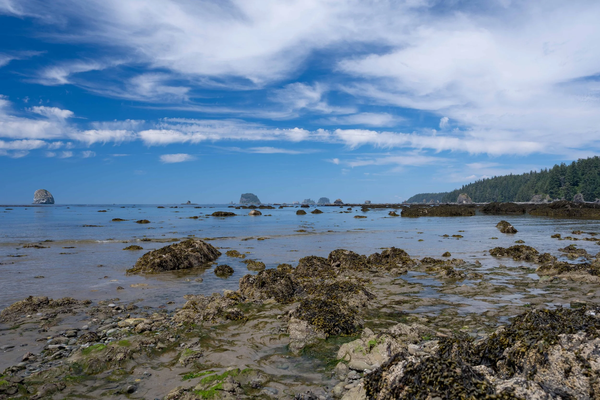
Pacific Ocean beach on the Ozette Triange hiking loop
The tide was WAY out, so there was no concern about skipping or jumping or navigating around headlands. Apparently, during high tides, navigation can be a real concern. I enjoyed a picnic lunch on a rock overlooking the Pacific before heading back to the southern campground where I found the trail entrance and hiked back to the main Ozette Trailhead. Back at Merlin, I got out my maps and headed to Bogachiel State Park. I need to dump my gray water (I had taken a couple hours by now), refill my fresh water tanks, get Diesel, and put some DEF in the engine. This was my first taste of needing a logistics-type stop on a longer road trip. Most all my previous trips in Merlin have been weekend trips or trips lasting up to 3-5 days. This trip would be 12 days in total and I needed a resupply stop. So, I headed towards Forks to do all those things! In Forks, I got Diesel and bought a gallon of DEF as the gauge was getting towards the “mid-point” at which point I needed to refill the exhaust fluid. It was too late in the day to book a site at Bogachiel State Park - but I noticed a couple sites that were open - according to the website, so I took my chance and pulled into the state park to visit the dump station and refill fresh water. Sure enough, the two available sites from the website schedule were still open - so I snagged site #1 which turned out to be a really nice quiet spot in the forest.
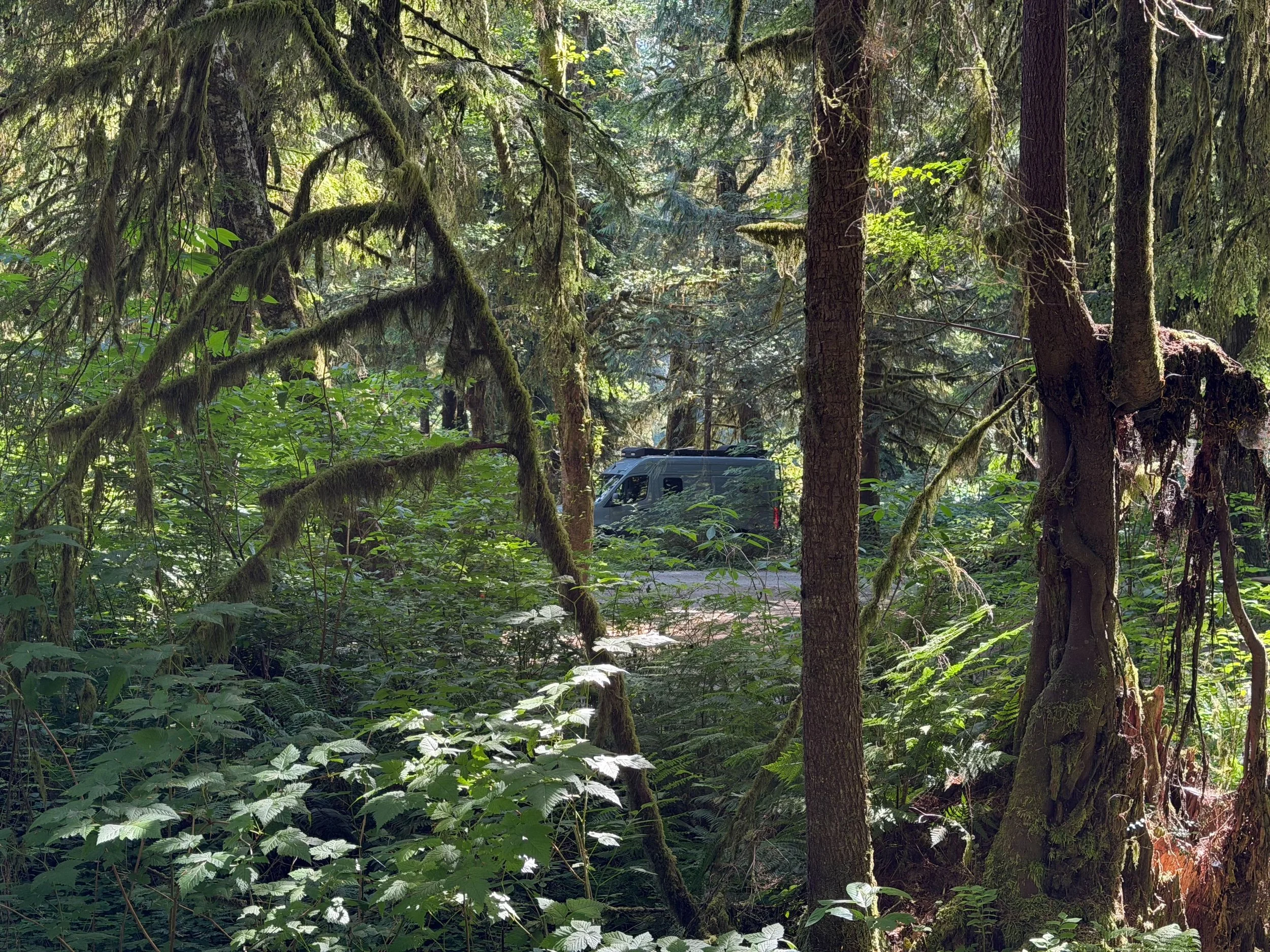
Bogachiel State Park
While making dinner, I thought I had heard an odd-sounding Killdeer flying around the campground. That seemed unusual to me, so I turned on the Merlin bird app and it picked up an actual Merlin (and I was sitting in my van - Merlin!). So, I went to the Sibley app and pulled up the Merlin and listened to some of the calls. Sure enough, there was an actual Merlin flying around me. The Birder’s Guide to WA book suggested that Merlins nest in some of these forests - so it was really neat to experience this. I don’t think I’d ever HEARD a Merlin before! I slept very peacefully that night and woke up the next day with a mission to hike part of the Bogachiel River Trail which was just across Hwy 101 and up a winding road from the campground. The trailhead had about 6 cars when I arrived. I took off and walked down the trail to a split - left was the Ira Spring nature trail and right was the Bogachiel River Trail which would enter the National Park in a few miles. I decided to take the Ira Spring trail and was absolutely amazed at this beautiful trail. The old growth trees were wonderful to hike through. Birdsong was everywhere. I kept my eyes open for bear or elk - which I didn’t see. I did see a young bride and groom getting their wedding photos taken in this forest by a photographer! And, I saw two backpackers from Belgium and a group of 4 tourists out on a little stroll along this beautiful trail. Where the Ira Spring nature trail meets up with the main Bogachiel River Trail again, I decided to walk the 1.8 or so miles back to the Trailhead. I thought about hiking .5 mile to the National Park boundary, but decided to just head out. Back at the van, I had a bit of lunch and then headed to Forks for some food for the night. I bought a steak and some instant mashed potatoes at the town’s little grocery store. I’d grill out the steak at Sol Doc campground that night.
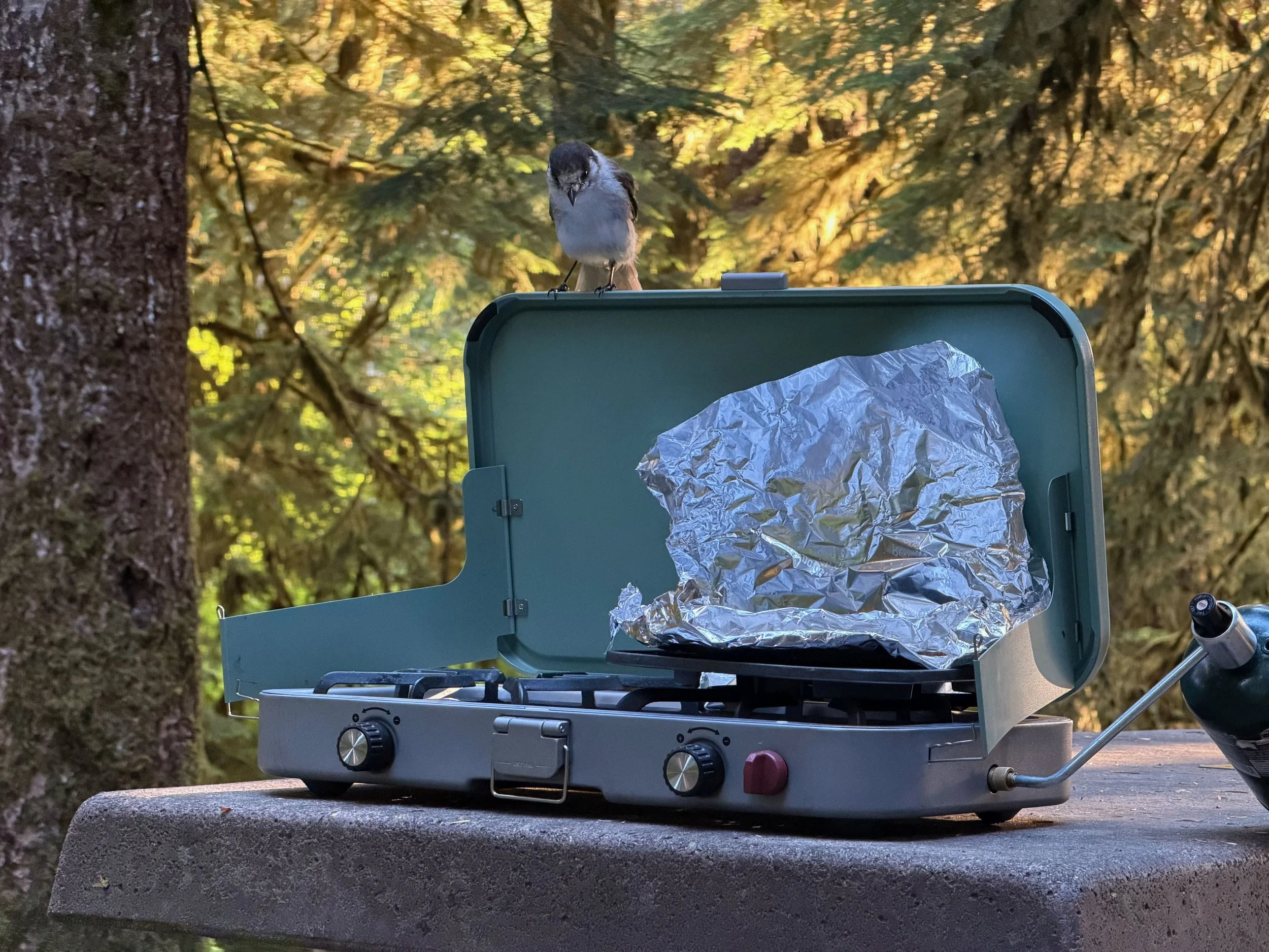
Canada Jay scoping out my steak at Sol Duc Campground.
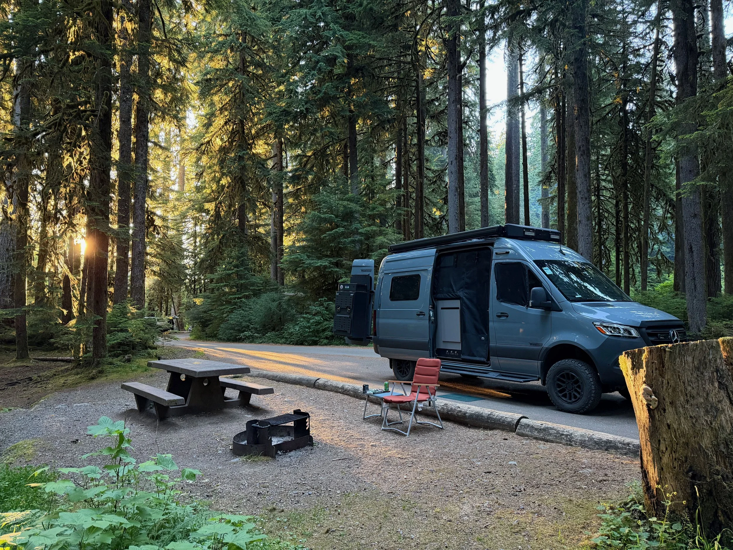
My campsite at Sol Duc was most excellent. It was site A18 - a great pull through with no nearby campsites and a view out into the forest. I set up my grill for the steak as a Canada Jay approached. Thankfully, he didn’t get any of my steak! There was a nice sunset that night at the campground - which would turn out to be the last sunset of the entire trip where I actually saw the sun! Even though the campground was full, it didn’t really seem too crowded. I will definitely come back to this area!
Thursday (now on week into the trip), I woke up and walked around the campground looking/listening for birds. The photo workshop would start later in the day, so I casually hung out at camp for a bit before moving on back to Port Angeles to meet the workshop crew!